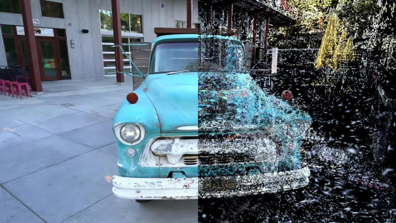
Source scan
25M+ points
The original Luminy LiDAR tile before filtering
A Unity VR experience that turns LiDAR scans into lightweight 3D buildings and lets players cut virtual objects naturally with a sword.
Results
25M+ points
The original Luminy LiDAR tile before filtering
70K-80K points
Typical isolated point cloud used for one building
2K-5K faces
Simplified range used to keep the scene responsive
~3 ms
Fast radial method on a boundary of about 50 points
Technical snapshot
From real-world scans to interactive VR geometry
Geometry processing and Unity VR implementation
8-week Master GIG project, 2026
Python, Open3D, CloudCompare, Unity
IGN LiDAR HD data from the Luminy area
Reconstructed building and VR slicing demo
Research Project
Case study
LiDAR data contains millions of separate points rather than ready-to-use surfaces, so it is too heavy and incomplete for direct use in Unity. At the same time, many games only play a prepared cutting animation, meaning an object always breaks in the same way regardless of how the player swings the tool.
Turn large sets of scanned points into usable 3D models, then create a convincing VR cutting interaction that follows the position and angle chosen by the player.
The team filtered IGN LiDAR data to isolate buildings, joined nearby points into surfaces, repaired missing areas and simplified each model for real-time display. In Unity, a dynamic cutting system divides an object along the player's movement and rebuilds the newly exposed interior with colored layers.
The project produced a recognizable low-poly building from real Luminy scan data and an interactive VR demonstration where objects split into two parts without noticeable delay. A faster method for rebuilding the cut interior reduced a representative calculation from 2.7 seconds to about 3 milliseconds.
Technical foundation
Evolution
2026
Filtered the Luminy dataset and turned building point clouds into repaired, simplified surfaces.
2026
Connected the player's sword movement to a cut that divides the actual geometry in real time.
2026
Combined the reconstructed building and slicing system in an explorable Unity environment.
Comparison
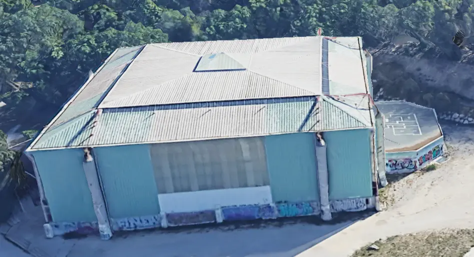
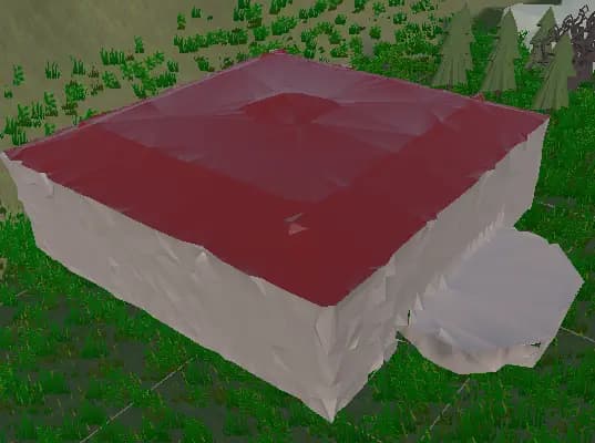
The real Luminy building used as a visual reference and the lightweight 3D model reconstructed from its LiDAR scan for use in Unity.
Process
Start with a large IGN scan made of millions of points representing terrain, trees and buildings.
Input
Filter the scan and separate useful building points from the surrounding environment.
Preparation
Connect the points into visible surfaces, close small gaps and correct incorrectly facing areas.
Reconstruction
Reduce the number of faces so the reconstructed building remains recognizable but runs smoothly in VR.
Optimization
Use the sword movement to define the real position and angle of each cut instead of playing a fixed animation.
Interaction
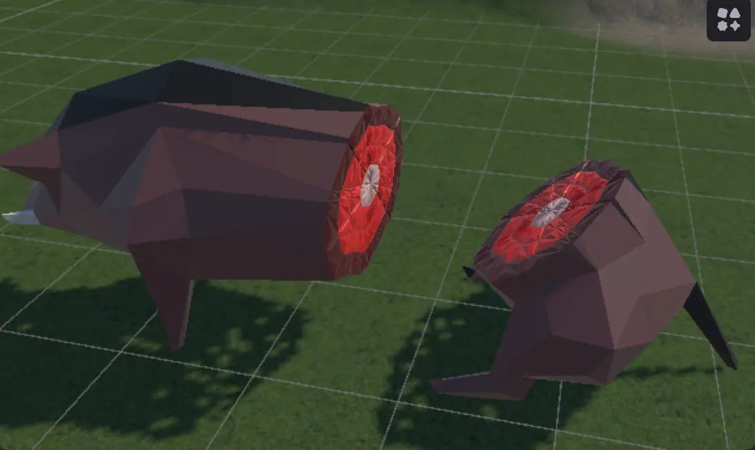
Close the cut immediately and add colored inner layers before displaying the two resulting objects.
Output
Start with a large IGN scan made of millions of points representing terrain, trees and buildings.
Input
Filter the scan and separate useful building points from the surrounding environment.
Preparation
Connect the points into visible surfaces, close small gaps and correct incorrectly facing areas.
Reconstruction
Reduce the number of faces so the reconstructed building remains recognizable but runs smoothly in VR.
Optimization
Use the sword movement to define the real position and angle of each cut instead of playing a fixed animation.
Interaction
Close the cut immediately and add colored inner layers before displaying the two resulting objects.
Output
Project evidence
video
Project demonstration showing the reconstructed environment and real-time geometry interactions in Unity VR.
image
The reconstructed interior layers shown after an object is cut in the VR experience.
3D model
Model slot for a Unity-ready building reconstructed from IGN LiDAR data.
Implementation detail
Knowledge base
website
The open geographic dataset used to reconstruct buildings from the Luminy area.
documentation
The 3D data library used for point-cloud processing, surface reconstruction and mesh simplification.
documentation
Unity guidance for building and testing immersive applications.
References
Keep exploring